CNC UK Heightmap: Difference between revisions
Jump to navigation
Jump to search
No edit summary |
No edit summary |
||
| (4 intermediate revisions by one other user not shown) | |||
| Line 13: | Line 13: | ||
|qrmode=1 | |qrmode=1 | ||
}} | }} | ||
I found a website called [http://jthatch.com/Terrain2STL/ Terrain2STL] and used it to produce this topographic map of the UK. | |||
Toolpaths were programmed from the STL file in [[Fusion 360]]. The toolpaths used were: Adaptive Clearing & Parallel. | |||
[[File:UK Heightmap (10).jpg|300px|thumb|left|Fusion 360 was used to produce the toolpaths]] | |||
{{clear}} | |||
==Gallery== | ==Gallery== | ||
<gallery mode=packed-hover heights=300px> | <gallery mode=packed-hover heights=300px> | ||
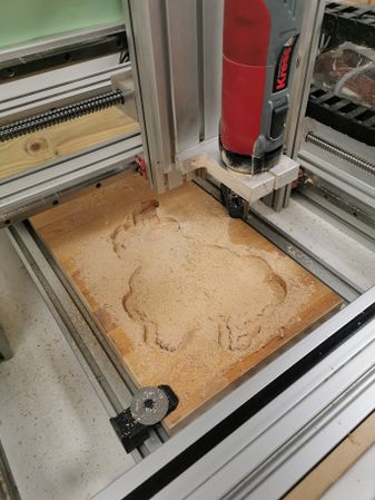
File:UK Heightmap (1).jpg | File:UK Heightmap (1).jpg|Rough Cut (Adaptive Clearing) | ||
File:UK Heightmap (2).jpg | File:UK Heightmap (2).jpg|Rough Cut (Adaptive Clearing) | ||
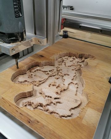
File:UK Heightmap (3).jpg | File:UK Heightmap (3).jpg|Finishing Cut (Parallel) | ||
File:UK Heightmap (4).jpg | File:UK Heightmap (4).jpg|Finishing Cut (Parallel) | ||
File:UK Heightmap (5).jpg | File:UK Heightmap (5).jpg|Trimming on the Bandsaw | ||
File:UK Heightmap (6).jpg | File:UK Heightmap (6).jpg|Sanding and manual correction | ||
File:UK Heightmap (7).jpg | File:UK Heightmap (7).jpg|Completed bare wood | ||
File:UK Heightmap (8).jpg | File:UK Heightmap (8).jpg|Painted map | ||
File:UK Heightmap (9).jpg | File:UK Heightmap (9).jpg|Painted map | ||
</gallery> | </gallery> | ||
[[Category:CNC Projects]] | |||
[[Category:Maps and plans]] | |||
Latest revision as of 17:03, 13 January 2020
| CNC UK Heightmap | |
|---|---|
.jpg) | |
| Primary Contact | Dan Spencer |
| Created | 18/12/2019 |
| Completed | 20/12/2019 |
| Status | Complete |
| Type | Members Project |
I found a website called Terrain2STL and used it to produce this topographic map of the UK.
Toolpaths were programmed from the STL file in Fusion 360. The toolpaths used were: Adaptive Clearing & Parallel.
.jpg)
Gallery
-
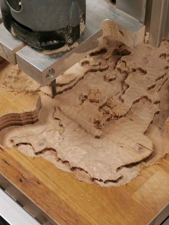 Rough Cut (Adaptive Clearing)
 -
 Rough Cut (Adaptive Clearing)
 -
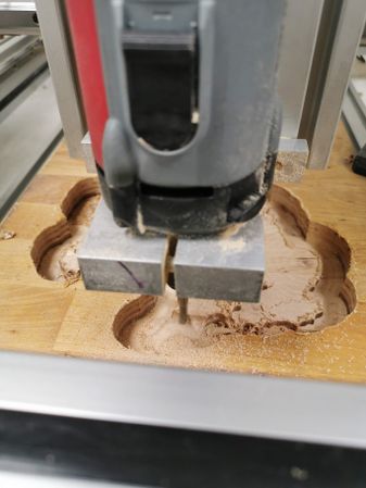 Finishing Cut (Parallel)
 -
 Finishing Cut (Parallel)
 -
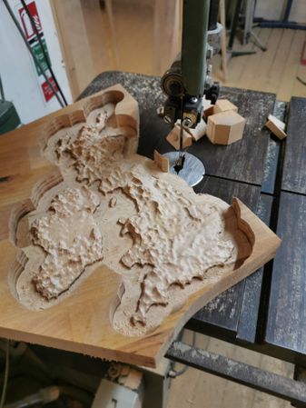 Trimming on the Bandsaw
 -
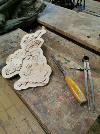 Sanding and manual correction
 -
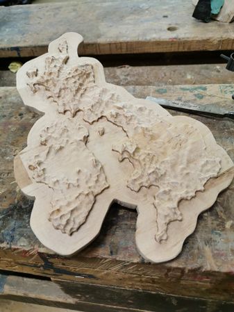 Completed bare wood
 -
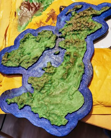 Painted map
 -
 Painted map
.jpg)
.jpg)
.jpg)
.jpg)
.jpg)
.jpg)
.jpg)
.jpg)